Winter Storm Watch Issued For Southern Minnesota
Rochester, MN (KROC AM News) - It looks more and more certain the southern third of Minnesota will be affected by an Easter Day winter storm that could dump several inches of snow across the region.
Cold air from Canada will combine with a storm system from the south to produce rain and then heavy snow that could linger into Monday.
A winter storm watch will be in effect Sunday into Monday for a large part of southern Minnesota and parts of Iowa and Wisconsin.
Here is the latest from the National Weather Service as of 7:00 AM Saturday:
A strong, late-season winter storm will track across the Midwest Sunday into Monday. This system will bring wintry weather to much of the region.
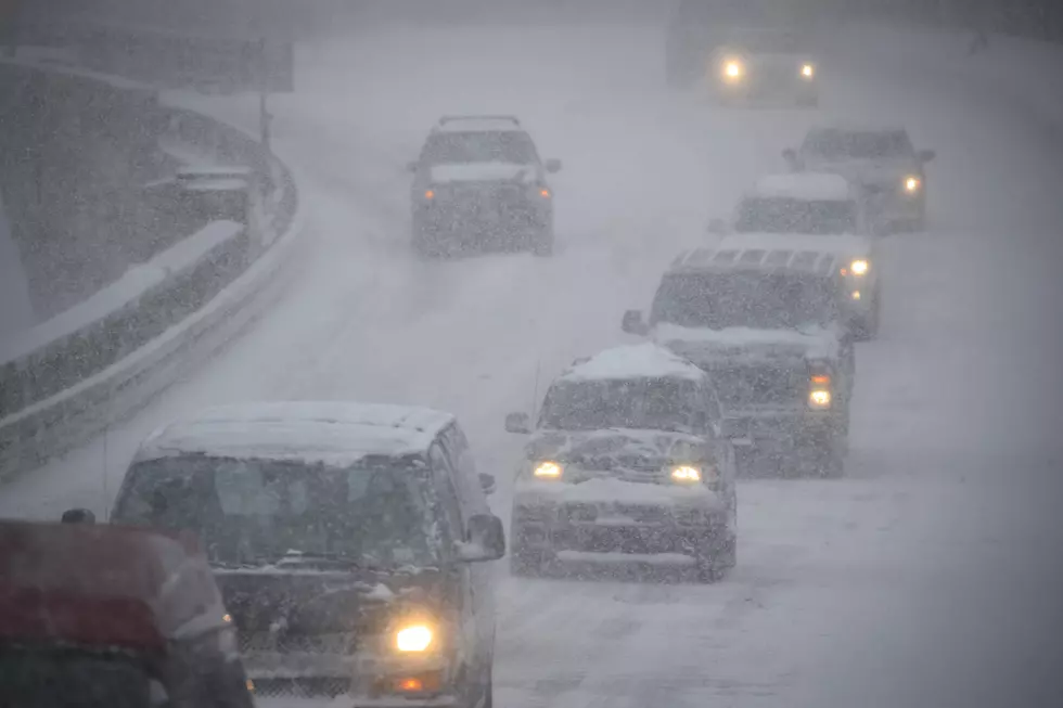
Rain will give way to a period of heavy snow across parts of the area Sunday into early Monday. Snowfall rates of 1 inch per hour or higher could occur Sunday afternoon and evening, allowing the snow to quickly accumulate.
A swath of heavy, wet snow accumulation is expected to stretch from north-central Iowa across southeast Minnesota and into north-central Wisconsin. Snowfall rates of 1+" per hour could occur in some areas Sunday afternoon and evening, allowing the snow to quickly accumulate. This snow will be wet and heavy and could cause tree damage and some power outages. As the system departs, winds will become strong enough to result in drifting and blowing snow late Sunday into Monday, which could lead to very poor visibility for travelers, especially in open, rural areas.
In addition, this will be a heavier, wet snow that could cause problems for any temporary tents that have been set up. Some tree damage and power outages could also occur. Blowing and drifting snow will also be possible through Monday.
The last time the Rochester area had any significant snow was Feb. 17th when just over 4 inches fell in the city.
More From KFIL


![Dolly Parton’s Hilarious Quarantine Poem Says What We’re All Thinking [Watch]](http://townsquare.media/site/204/files/2020/04/dolly-parton-poem-quarantine-coronavirus.jpg?w=980&q=75)